 Resa Routes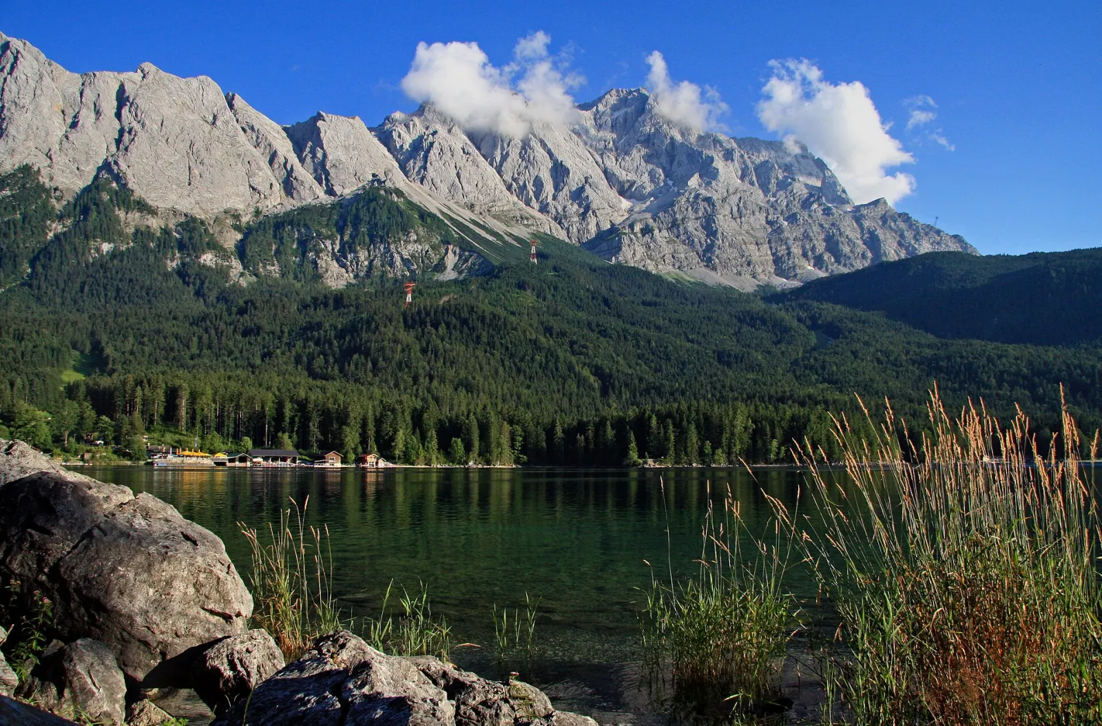
Hiking · Bavaria
Hiking trails around Garmisch-Partenkirchen
36 waymarked hiking trails around Garmisch-Partenkirchen (Bavaria), from OpenStreetMap. We calculated the length from the route’s course.
Also here:Cycling · 3

Garmisch-Partenkirchen sits at the foot of the Wetterstein range and the Zugspitze, Germany's highest mountain. Trails range from valley walks to Alpine Club paths into the Höllental or up to the Schachen. Two places draw the biggest crowds: the Partnach Gorge, about 700 m long and more than 80 m deep, behind the Olympic ski stadium, and the Eibsee below the Zugspitze, circled by a path of just over 7 km. On the north side of the valley, trails cross the Kramer plateau. Several stages of the Via Alpina pass through, so the area also works well for multi-day walking.
Good to know
- By train: the Werdenfels line (RB6) runs hourly and directly from München Hbf to Garmisch-Partenkirchen.
- Bus 323 runs via Grainau to the Eibsee (hourly, as of 2026); the Zugspitze cog railway also stops there. The lake circuit starts at the car park in front of the Eibsee-Hotel.
- The Partnach Gorge is open all year but may close in bad weather. From the car park at the Olympic ski stadium it is about 25 minutes on foot to the entrance; there is an admission fee.
- The Eibsee circuit is rated easy: about 7.5 km, roughly two hours.
Our picks
- Eibsee Rundwanderweg — The circuit around the Eibsee, 7.0 km in our data, with the Zugspitze in view.
- Kramerplateauweg — 6.6 km across the Kramer plateau on the north side of the valley.
- Panoramaweg Grainau — A 9.3 km panorama path in Grainau, handy if you stay along the Eibsee bus line.
- AV Weg 831A (Höllental) — Alpine Club path into the Höllental, 5.1 km, not a loop.
E4.004[E4] Europäischer Fernwanderweg [004]
On OpenStreetMap ↗801AV Weg 801
On OpenStreetMap ↗Wegenetz der Gemeinde Garmisch-Partenkirchen
On OpenStreetMap ↗VA-A60Via Alpina Purple A60
On OpenStreetMap ↗VA-R44Via Alpina Red R44
On OpenStreetMap ↗VA-A59Via Alpina Purple A59
On OpenStreetMap ↗Wegenetz der Gemeinde Farchant
On OpenStreetMap ↗VA-R45Via Alpina Red R45
On OpenStreetMap ↗841AV Weg 841 (Schachenweg)
On OpenStreetMap ↗Pa-GrPanoramaweg Grainau
On OpenStreetMap ↗EibEibsee Rundwanderweg
On OpenStreetMap ↗KRKramerplateauweg
On OpenStreetMap ↗874AV Weg 874 (Schützensteig)
On OpenStreetMap ↗K&WKlima & Wasser im Wandel
On OpenStreetMap ↗255Kramersteig
On OpenStreetMap ↗835aAV Weg 835 (Bernadeinsteig)
On OpenStreetMap ↗821Bayernsteig
On OpenStreetMap ↗831AAV Weg 831A (Höllental)
On OpenStreetMap ↗870AV Weg 870 (Bannholzweg)
On OpenStreetMap ↗Höhenweg Höllental Eibsee
On OpenStreetMap ↗Höllentalsteig
On OpenStreetMap ↗PhPhilosophenweg
On OpenStreetMap ↗842AV Weg 842 (Kaelbersteig)
On OpenStreetMap ↗R17Route 17
On OpenStreetMap ↗Sagenhafter Bergwald
On OpenStreetMap ↗Matheisenkar
On OpenStreetMap ↗860AV Weg 860
On OpenStreetMap ↗Stangensteig
On OpenStreetMap ↗AV Weg 835a (Bernadeinsteig - Stuibensee - Schöngänge)
On OpenStreetMap ↗875AV Weg 875
On OpenStreetMap ↗807Wanderweg 807 (blau)
On OpenStreetMap ↗Jägersteig
On OpenStreetMap ↗AV Weg 834 (Schöngänge)
On OpenStreetMap ↗Der Geologische Lehrpfad "Die Steine des Alpenraums"
On OpenStreetMap ↗862AV Weg 862
On OpenStreetMap ↗255aKramersteig - Königsstand
On OpenStreetMap ↗