 Resa Routes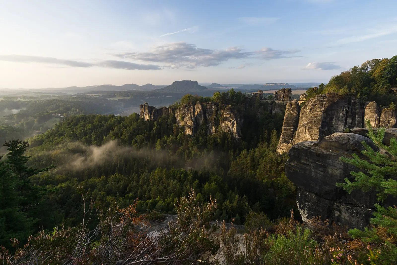
Hiking · Saxony
Hiking trails around Saxon Switzerland
49 waymarked hiking trails around Saxon Switzerland (Saxony), from OpenStreetMap. We calculated the length from the route’s course.
Photo: Andreas Gräwe · CC BY-SA 4.0

The Elbe Sandstone Mountains south-east of Dresden are not high mountains but a landscape of table mountains such as the Lilienstein, rock ridges such as the Schrammsteine, and narrow ravines in between. Much of it lies within Saxon Switzerland National Park. The Elbe splits the region; S-Bahn trains and ferries link the two banks, and the Kirnitzsch valley tram reaches trails deep inside the park. Well-known goals are the Bastei with its stone bridge of 1851, and the Malerweg, a 112 km long-distance trail in eight stages of 10 to 20 km a day. Almost all routes in our data are footpaths, plus a few cycle routes along the valleys.
Good to know
- By train: S-Bahn line S1 runs up the Elbe from Dresden to stops including Kurort Rathen and Bad Schandau. Rathen is car-free; from the station a ferry crosses the Elbe.
- The Kirnitzsch valley tram has run since 1898, about 8 km from Bad Schandau to the Lichtenhain waterfall. Its nine stops are trailheads into the national park.
- As of August 2026: after a storm on 31 July 2026, a forest area around the Amselgrund between the Bastei, Rathen, Hohnstein and the Polenz valley is closed. Check current closures before setting out.
- Malerweg: 112 km in eight stages, clockwise from Liebethal to Pirna.
Our picks
- Basteirundweg — A 9.5 km loop to the Bastei. Check the August 2026 closures around Rathen first.
- Caspar-David-Friedrich-Weg — A 14.6 km loop maintained by Sachsenforst and named after the painter.
- Malerweg — The entire Malerweg as one line, 116.9 km in our data – a multi-day route.
Malerweg
On OpenStreetMap ↗LSLausitzer Schlange 2: Rathen – Valtenberg
On OpenStreetMap ↗Sebnitztalweg
On OpenStreetMap ↗Wachberg - Lilienstein
On OpenStreetMap ↗Gelber Strich
On OpenStreetMap ↗Ostrauer Mühle - Sebnitz
On OpenStreetMap ↗Wachberg - Schrammsteinaussicht
On OpenStreetMap ↗Gelber Punkt, Panoramaweg
On OpenStreetMap ↗Rund um Ulbersdorf
On OpenStreetMap ↗Postelwitz - Zeughaus
On OpenStreetMap ↗Caspar-David-Friedrich-Weg
On OpenStreetMap ↗Goßdorf
On OpenStreetMap ↗Flößersteig
On OpenStreetMap ↗Rundweg Gelber Punkt
On OpenStreetMap ↗Gelber Balken, Sebnitz Busbahnhof-Tanzplan
On OpenStreetMap ↗Naturkundlicher Lehrpfad Gohrisch
On OpenStreetMap ↗Lehrpfad Hohnstein
On OpenStreetMap ↗Tk9Tk9
On OpenStreetMap ↗0312[Č] Hřensko (nábřeží) – Mezní louka
On OpenStreetMap ↗Tk8Basteirundweg
On OpenStreetMap ↗Grüner Punkt
On OpenStreetMap ↗Rundweg Grüner Strich
On OpenStreetMap ↗Rundweg Ottendorf-Kirnitzschtal (Gelber Punkt)
On OpenStreetMap ↗Rundweg Hundskirche
On OpenStreetMap ↗Lohsdorfer Rundweg
On OpenStreetMap ↗Geopfad Goßdorf
On OpenStreetMap ↗Oberer Rundweg
On OpenStreetMap ↗Tk14Tk 14
On OpenStreetMap ↗Blauer Strich
On OpenStreetMap ↗Folgen Rundweg
On OpenStreetMap ↗Rundweg Königstein
On OpenStreetMap ↗Sebnitz Bahnhof-Hertigswalde Gelber Punkt
On OpenStreetMap ↗Rundweg Gelber Punkt
On OpenStreetMap ↗Ulbersdorf - Schönbach
On OpenStreetMap ↗Blümelpfad
On OpenStreetMap ↗Bodenlehrpfad Sächsische Schweiz
On OpenStreetMap ↗Tk7Rollstuhlrundweg
On OpenStreetMap ↗Ottendorfer Rundgang
On OpenStreetMap ↗Finkenberg Rundweg Grüner Punkt
On OpenStreetMap ↗Bergpfade Wehlener Gebiet
On OpenStreetMap ↗[Č] Státní hranice Schmilka – Hřensko (nábřeží)
On OpenStreetMap ↗Patrouillenweg
On OpenStreetMap ↗Bergpfad Gehackter Weg
On OpenStreetMap ↗Tk1Elbpromenade
On OpenStreetMap ↗Tk12Tk 12
On OpenStreetMap ↗