 Resa Routes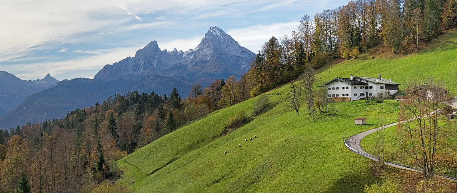
Hiking · Bavaria
Hiking trails around Berchtesgaden
77 waymarked hiking trails around Berchtesgaden (Bavaria), from OpenStreetMap. We calculated the length from the route’s course.
Photo: Jörg Braukmann · CC BY-SA 4.0
.jpg)
The south of the Berchtesgaden area is taken up by Berchtesgaden National Park: founded in 1978, it is Germany's only national park in the Alps, about 210 km² in size with more than 250 km of trails. The Watzmann, the Hochkalter and the Königssee define the scenery. Most routes in our data are Alpine Club paths, many of them long approaches to huts and passes. There are also quieter paths around Ramsau and Berchtesgaden, such as the Soleleitungsweg along the old brine pipeline. For something less steep, the electric boat crosses the Königssee to St. Bartholomä or Salet, and from Salet a short walk leads to the Obersee.
Good to know
- By public transport: train via Freilassing to Berchtesgaden Hbf (Berchtesgadener Land Bahn), then RVO bus 841 towards Königssee; the shore is about 5 minutes from the stop.
- The Königssee boats are electric: about 35 minutes to St. Bartholomä and roughly 20 minutes more to Salet. From Salet the Obersee is a fifteen-minute walk.
- In the national park, stay on marked trails to protect plants and wildlife in the core zone.
- About 20 minutes out, the boat stops at the Echowand, where a trumpet or horn demonstrates the echo off the rock face.
Our picks
- Wanderweg 1 (Soleleitungsweg) — 20.8 km along the historic brine pipeline, one way.
- Malerwinkelrundweg — A short 3.1 km path at the Königssee that fits before or after the boat trip.
- Almerlebnispfad — A 10.9 km circular trail maintained by the municipality of Ramsau.
- Wanderweg 70 (Rund um den Toten Mann) — A 12.3 km loop around the Toter Mann near Ramsau.
2Wanderweg 2 (Saumweg)
On OpenStreetMap ↗1Wanderweg 1 (Soleleitungsweg)
On OpenStreetMap ↗451AV Weg 451 (Göll Überschreitung)
On OpenStreetMap ↗482AV Weg 482 (Hochkalterüberschreitung)
On OpenStreetMap ↗417AV Weg 417
On OpenStreetMap ↗441AV Weg 441
On OpenStreetMap ↗493AV Weg 493 (Königssee - Gotzenalm - Landtal)
On OpenStreetMap ↗479AV Weg 479
On OpenStreetMap ↗475AV Weg 475
On OpenStreetMap ↗417AV Weg 417
On OpenStreetMap ↗70Wanderweg 70 (Rund um den Toten Mann)
On OpenStreetMap ↗466AV Weg 466
On OpenStreetMap ↗AlmAlmerlebnispfad
On OpenStreetMap ↗443AV Weg 443 (Königssee - Kühroint - Rinkendlsteig - St. Bartolomä)
On OpenStreetMap ↗74Wanderweg 74
On OpenStreetMap ↗477AV Weg 477
On OpenStreetMap ↗442AV Weg 442
On OpenStreetMap ↗78Wanderweg 78 (Rund um den Niernthalkopf)
On OpenStreetMap ↗Almbachklamm
On OpenStreetMap ↗497AV Weg 497 (Hinterbrand - Seeleinsee)
On OpenStreetMap ↗Panoramaweg Bischofswiesen
On OpenStreetMap ↗75Wanderweg 75 (Rund um den Schmuckenstein)
On OpenStreetMap ↗444AV Weg 444
On OpenStreetMap ↗HKTHerz-Kreislauf Testwanderweg
On OpenStreetMap ↗61Wanderweg 61 (Schattseitweg)
On OpenStreetMap ↗486AV Weg 486 (Hochkalter)
On OpenStreetMap ↗VA-A44Via Alpina Purple A42
On OpenStreetMap ↗59Wanderweg 59
On OpenStreetMap ↗Barmstein-Runde
On OpenStreetMap ↗76Wanderweg 76 (Rund um den Ochsenkopf)
On OpenStreetMap ↗67Wanderweg 67
On OpenStreetMap ↗72Wanderweg 72 (König-Max-Weg)
On OpenStreetMap ↗81Wanderweg 81
On OpenStreetMap ↗77Wanderweg 77 (Rund um den Burgstallkopf)
On OpenStreetMap ↗457AV Weg 457 Alpeltalsteig
On OpenStreetMap ↗476AV Weg 476
On OpenStreetMap ↗Tristramschlucht
On OpenStreetMap ↗485AV Weg 485
On OpenStreetMap ↗66Wanderweg 66
On OpenStreetMap ↗492AV Weg 492 [Kaunersteig]
On OpenStreetMap ↗64Wanderweg 64
On OpenStreetMap ↗445AV Weg 445
On OpenStreetMap ↗58Wanderweg 58
On OpenStreetMap ↗469Wanderweg 469
On OpenStreetMap ↗AV Weg 464
On OpenStreetMap ↗73Wanderweg 73 (Pfaffenthal-Rundweg)
On OpenStreetMap ↗494AV Weg 494 (Kessel - Gotzentalalm)
On OpenStreetMap ↗80Wanderweg 80
On OpenStreetMap ↗69Wanderweg 69 - Ramsau
On OpenStreetMap ↗Rinnkendlsteig
On OpenStreetMap ↗Rinnkendlsteig
On OpenStreetMap ↗71Wanderweg 71 (Rund um den Taubensee)
On OpenStreetMap ↗Malerwinkelrundweg
On OpenStreetMap ↗Kehlstein - Hoher Göl über Mannlgrat
On OpenStreetMap ↗75aWanderweg 75a
On OpenStreetMap ↗475aAV Weg 475a
On OpenStreetMap ↗65Wanderweg 65 (Kunterweg)
On OpenStreetMap ↗Friedensbergrunde
On OpenStreetMap ↗446AV Weg 446 (Eiskapelle)
On OpenStreetMap ↗62Wanderweg 62 (Prinzregent-Luitpold-Weg)
On OpenStreetMap ↗