 Resa Routes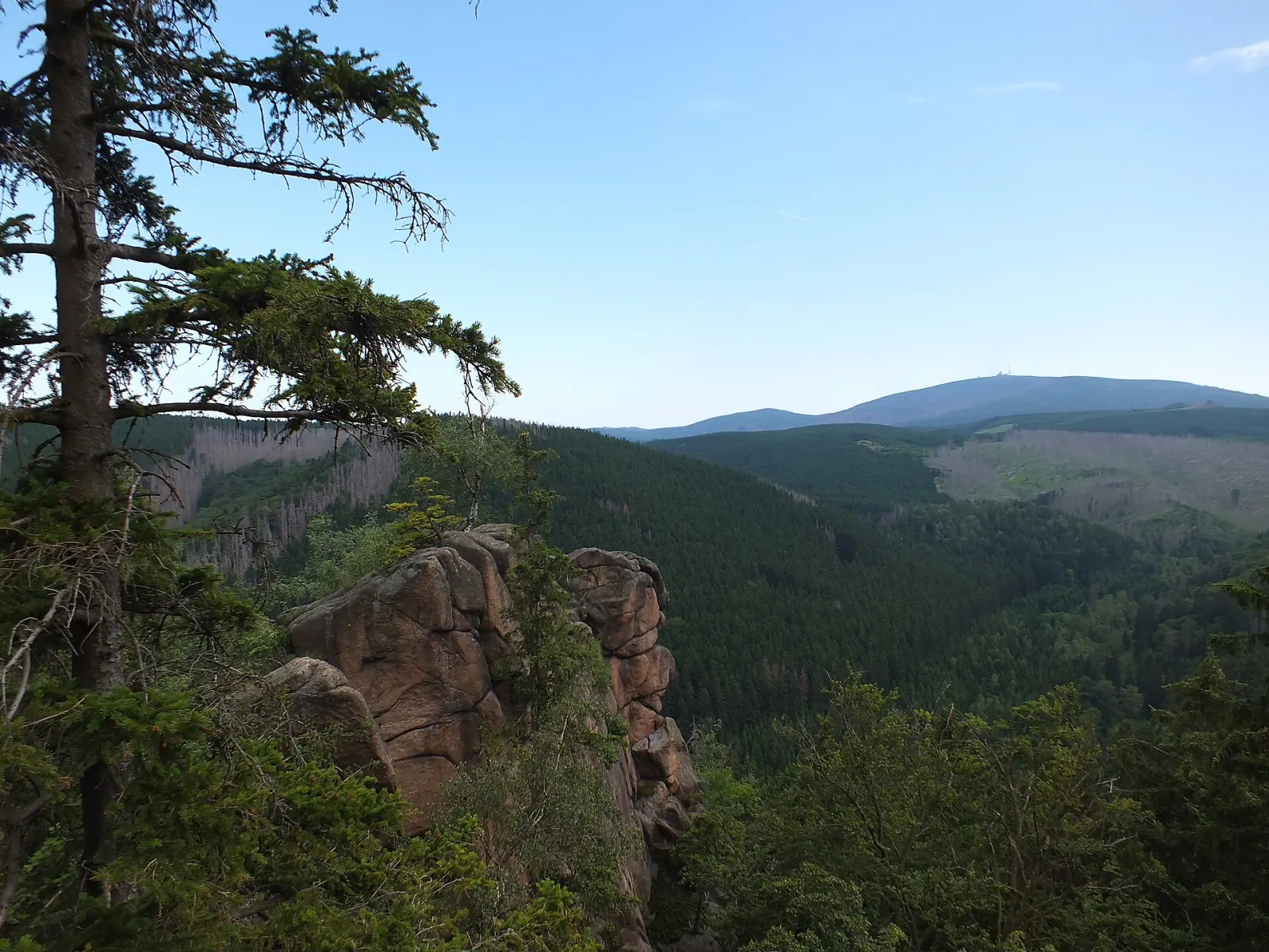
Mountain biking · Saxony-Anhalt
Mountain bike routes around Harz Mountains
7 waymarked MTB routes around Harz Mountains (Saxony-Anhalt), from OpenStreetMap. We calculated the length from the route’s course.
Photo: Kongo Mueller · CC BY-SA 3.0

At 1,141 m, the Brocken is the highest mountain in northern Germany and stands at the centre of Harz National Park. No public road leads to the top: you arrive on foot, by horse-drawn carriage, or on the Brocken railway of the Harz narrow-gauge network, which climbs from Wernigerode via Drei Annen Hohne and Schierke. Around Schierke and Ilsenburg are the national park's footpaths, plus signposted mountain bike tours with names like Klippen-Tour. One of the best-known ascents is the Goetheweg from Torfhaus, following Goethe's climb of 1777. At the summit, a short circuit loops around the plateau.
Good to know
- The HSB Brocken railway starts in Wernigerode; you can also board at Drei Annen Hohne and Schierke.
- The Brockenstraße is closed to public traffic. Walking it from the Schierke national park centre is about 10 km and 500 m of climbing.
- Goetheweg: 7.6 km from Torfhaus to the summit.
- The shortest ascent starts at the Oderbrück car park on the B4.
Our picks
- W7 Ilsenburger Klippen-Tour — A 24.9 km mountain bike loop over the crags near Ilsenburg.
W3Die Harz-Wald-Tour
On OpenStreetMap ↗W8W8 Hohnekamm Trail-Tour
On OpenStreetMap ↗W7W7 Ilsenburger Klippen-Tour
On OpenStreetMap ↗W6W6 Kleine Ilsestein-Tour
On OpenStreetMap ↗KWKammweg
On OpenStreetMap ↗JTRJack the Ripper
On OpenStreetMap ↗WTWassertal
On OpenStreetMap ↗